Sorry for the delay. I am currently studying and taking exams until November 17, so don't be alarmed, I am not going to let this blog die.
I thought I would post a gallery of the new Blind Creek Trail directional signage I spotted on a recent bike ride through Knox. When I rode on October 19, new signs had been installed between EastLink and Lewis Park (the park at the back of Knox City Shopping Centre), so hopefully more have been placed along the trail since that ride. The signage is of high quality wood, and the destinations are adequate for the trail, but could be better. I will review each sign and it's location under each of the following photos:

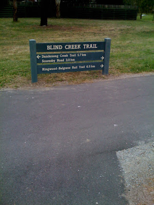
At the back of Knox City, with the sign telling riders there is a long and short way to Scoresby Road. Going right takes you along the actual trail while left goes along the northern border of Lewis Park. The destination of the Rail Trail helps keep the rider on the right trail.
On this note, I believe EVERY sign needs to have an arrow or arrows beside the trail name to clearly indicate which direction the official trail leads.

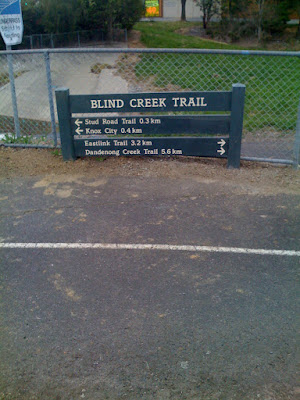
Same location as above, but heading the other way. Besides the lack of arrows (which I will no longer mention in this post), this sign is a good example of showing local destinations (Knox City and Stud Road) while also pointing out links to upcoming trail turn-offs.

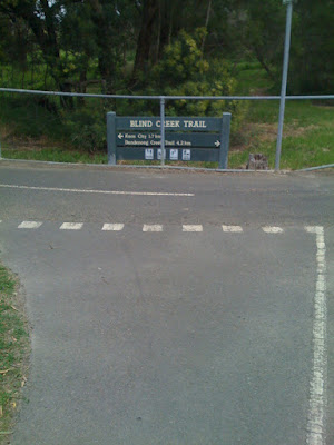
Simple sign at the turn-off for the short track which leads to the entry to Knox City near the post office.


Now, this is where you just want to slam your head against a brick wall. First, there is no signage for the dangerous section beside Stud Road between the back of Knox City and the intersection, but the new signage has NO MENTION OF THE STUD ROAD TRAIL AT ALL!!! I wonder who was responsible for this oversight. A major trail, running along Stud Road from the Dandenong Creek Trail to George Street and from Ferntree Gully Road to Rowville. How could this not be included. But I do like the inclusion of the 2 destinations for the two different ways to get to the Dandenong Creek Trail. Points on the board for that.
Another one without any mention of the Stud Road Trail, at the southern intersection of the Blind Creek Trail and the Stud Road Trail.
This is at the intersection of the Burwood Highway Trail on the northern side of Burwood Highway. The holes have been dug but no sign here yet.
Now, this sign is my favourite blooper. First of all, they put the sign in a spot where nobody riding on the Blind Creek Trail will read it, it is on the Burwood Highway Trail on the southern side of Burwood Highway instead. No mention of the Burwood Highway Trail, but amazingly, THERE IS A MENTION OF THE STUD ROAD TRAIL!!! These signs boggle the mind!
Eastern side of the Timothy Drive underpass.
Western side of the Timothy Drive underpass.
Strange setup here at the small link trail to Renou Road between High Street Road and Timothy Drive with the metal handrail obscuring the sign somewhat, but I guess there is not much choice of where to put it here!
Sign at the small link trail to Cathies Lane.
Sign at the small link trail to High Street Road on the northern side. Jells Park should have been included on this sign in my opinion.
Shockingly placed sign which makes it look like the trail runs on the southern side of High Street Road (the trail going off to the left of the pic) instead of going past where the photographer is standing.
The back of the same sign as above, facing open grass where nobody will read it, let alone know that there are directions on this side! This intersection needed a 2 sign setup here.
This sign was installed when the EastLink Trail opened, and was the first Blind Creek Trail directional signage installed. This sign was installed by EastLink, while the other signs featured were installed by Knox City Council.
The sign has the directional arrows next to the title which should be standard on all signs, as I mentioned above, but this intersection needed a 2 sign setup. One sign does not cover all directions and destinations, especially at such an important intersection.
Thats all for now! If they have been installed, I will post up pics of any new signs that have been installed around my area, along with my gruelling commentary!


 At the back of Knox City, with the sign telling riders there is a long and short way to Scoresby Road. Going right takes you along the actual trail while left goes along the northern border of Lewis Park. The destination of the Rail Trail helps keep the rider on the right trail.
 Same location as above, but heading the other way. Besides the lack of arrows (which I will no longer mention in this post), this sign is a good example of showing local destinations (Knox City and Stud Road) while also pointing out links to upcoming trail turn-offs.
 Simple sign at the turn-off for the short track which leads to the entry to Knox City near the post office.
 Now, this is where you just want to slam your head against a brick wall. First, there is no signage for the dangerous section beside Stud Road between the back of Knox City and the intersection, but the new signage has NO MENTION OF THE STUD ROAD TRAIL AT ALL!!! I wonder who was responsible for this oversight. A major trail, running along Stud Road from the Dandenong Creek Trail to George Street and from Ferntree Gully Road to Rowville. How could this not be included. But I do like the inclusion of the 2 destinations for the two different ways to get to the Dandenong Creek Trail. Points on the board for that.


